About Kasaragod
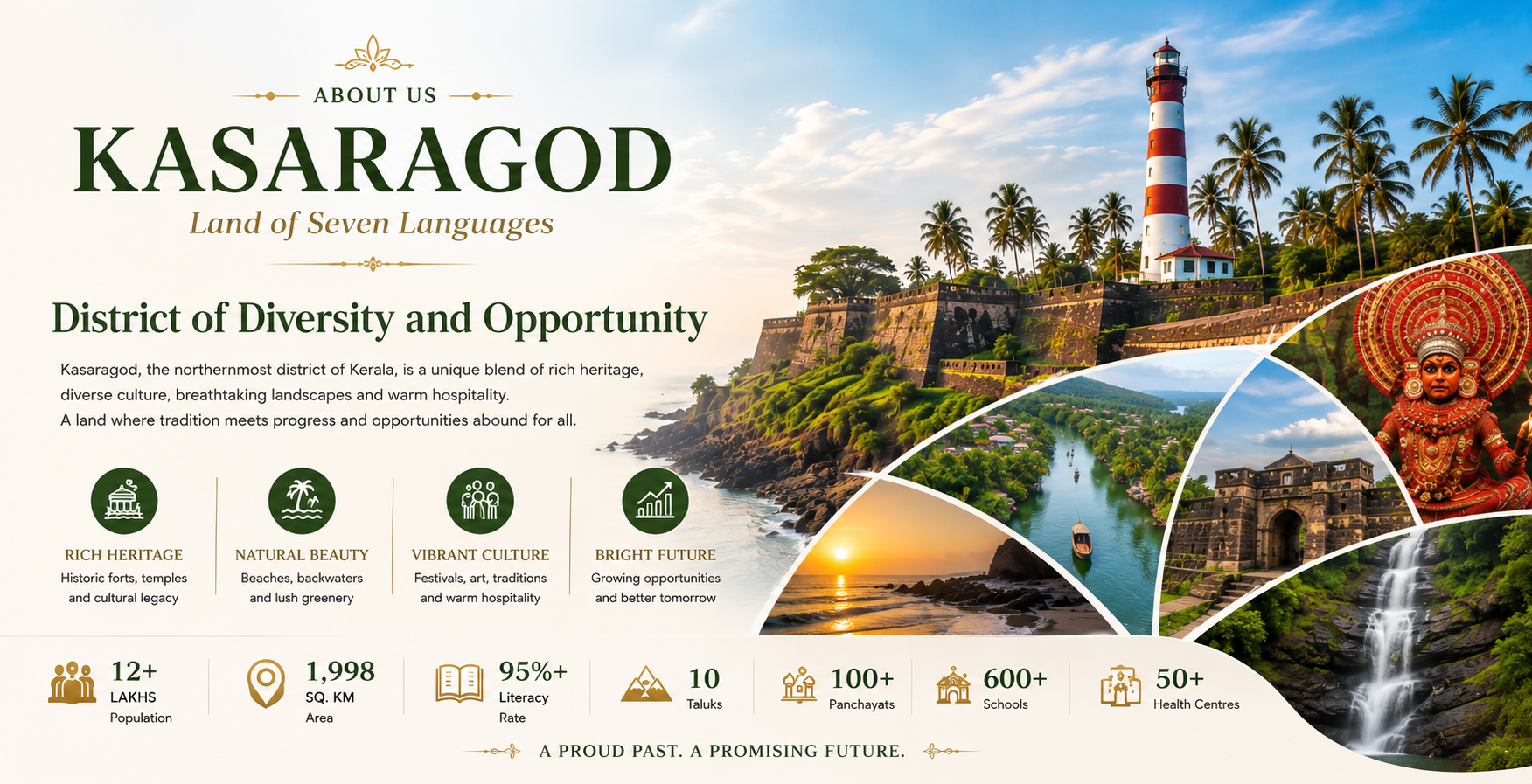
Kasaragod, the northernmost district of Kerala, is a land of breathtaking natural beauty, rich cultural heritage, and remarkable linguistic diversity. Popularly known as the Land of Seven Languages, the district is home to vibrant traditions, historic landmarks, serene backwaters, golden beaches, lush hills, and iconic forts.
Renowned for attractions like Bekal Fort, Chandragiri Fort, tranquil rivers, and scenic coastal landscapes, Kasaragod offers a perfect blend of history, nature, and modern development. Agriculture, tourism, education, and small-scale industries contribute significantly to the district’s growth, while its warm hospitality and cultural harmony make it a unique destination.
With a strong commitment to sustainable development, Kasaragod continues to preserve its heritage while embracing progress, creating opportunities for residents and visitors alike.
Overview of kasaragod
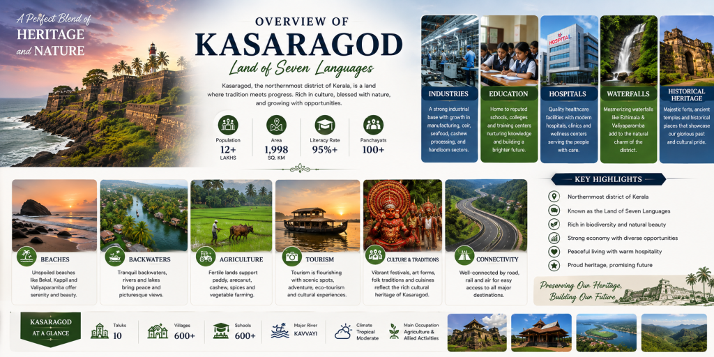
Kasaragod, the northernmost district of Kerala, is renowned for its rich cultural heritage, natural beauty, and remarkable linguistic diversity. Popularly known as the Land of Seven Languages, the district is home to historic forts, pristine beaches, serene backwaters, majestic waterfalls, lush hills, sacred temples, and vibrant cultural traditions. The district is an emerging center for tourism, agriculture, education, healthcare, and small-scale industries. Its well-developed road and rail connectivity, growing infrastructure, quality educational institutions, modern healthcare facilities, and peaceful environment make Kasaragod an ideal place to live, visit, and invest.From the iconic Bekal Fort to scenic coastal landscapes and thriving communities, the district offers a perfect harmony of heritage, nature, opportunity, and growth.
Geography & Location
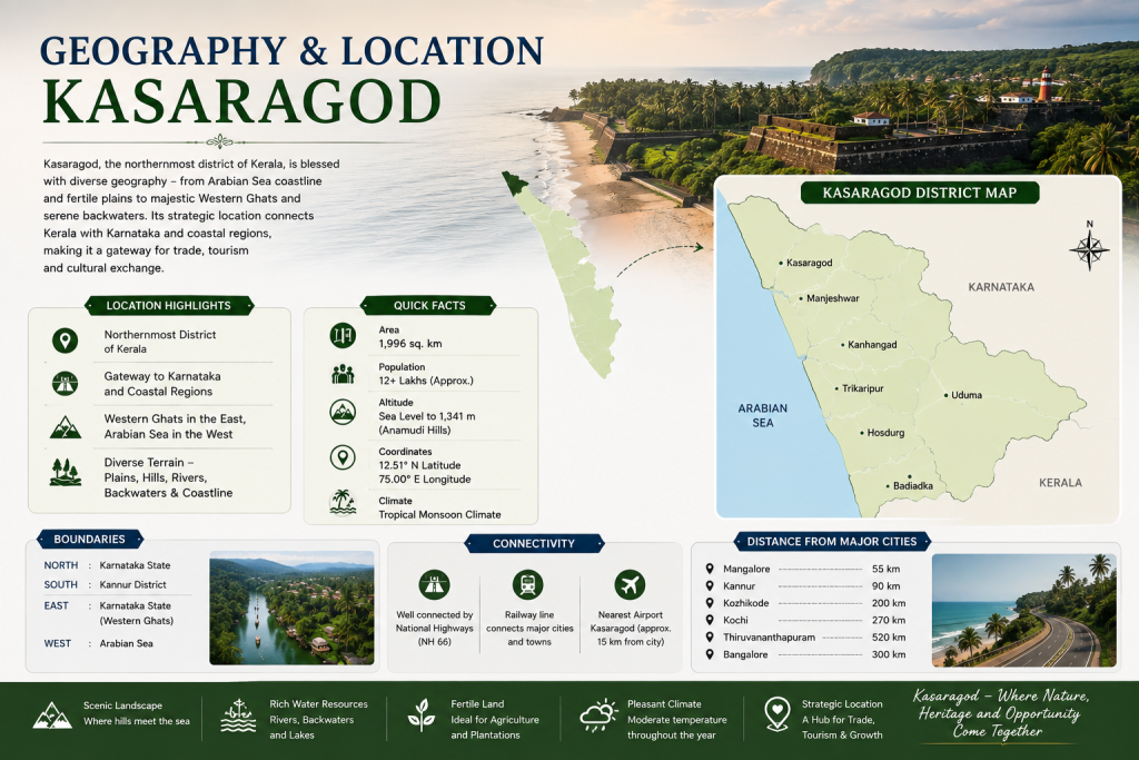
Kasaragod, the northernmost district of Kerala, enjoys a unique geographical setting that blends the Arabian Sea coastline with the lush Western Ghats. The district shares its northern and eastern boundaries with Karnataka, the southern boundary with Kannur district, and the western boundary with the Arabian Sea. This strategic location makes Kasaragod an important gateway connecting Kerala with Karnataka and the rest of South India.
The district is blessed with diverse landscapes, including pristine beaches, serene backwaters, rivers, rolling hills, dense forests, fertile plains, and picturesque waterfalls. Its tropical climate, abundant natural resources, and rich biodiversity support agriculture, tourism, fisheries, and sustainable development. With excellent road and rail connectivity and easy access to nearby airports and ports, Kasaragod continues to grow as a vibrant destination where nature, heritage, and modern development exist in perfect harmony.
Heritage & Culture

Kasaragod is a vibrant cultural destination where history, tradition, and diversity come together in perfect harmony. Known as the Land of Seven Languages, the district reflects a unique blend of Malayalam, Tulu, Kannada, Konkani, Beary, Marathi, and Urdu cultures. Its rich heritage is preserved through ancient forts, centuries-old temples, mosques, churches, traditional architecture, and sacred places that showcase the district’s historical significance.The cultural identity of Kasaragod is celebrated through colorful festivals, traditional art forms such as Theyyam and Yakshagana, folk music, dance, handloom weaving, coir crafts, and local cuisine. Iconic landmarks like Bekal Fort and Chandragiri Fort, along with vibrant cultural celebrations and warm hospitality, make Kasaragod a remarkable destination where timeless traditions continue to thrive while inspiring future generations.
Agriculture Backbone of Kasaragod District
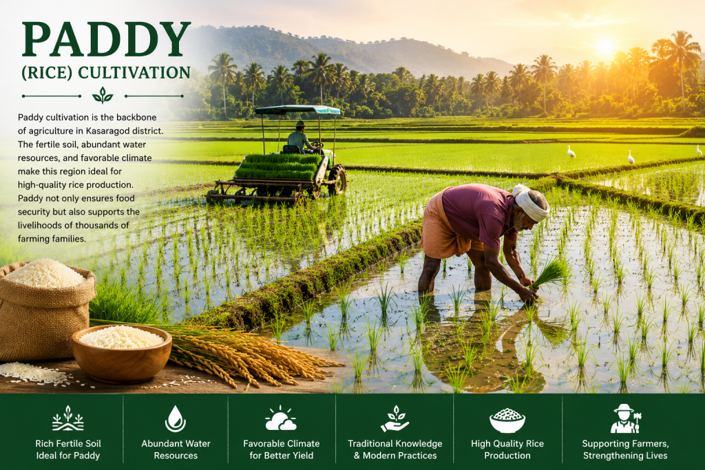
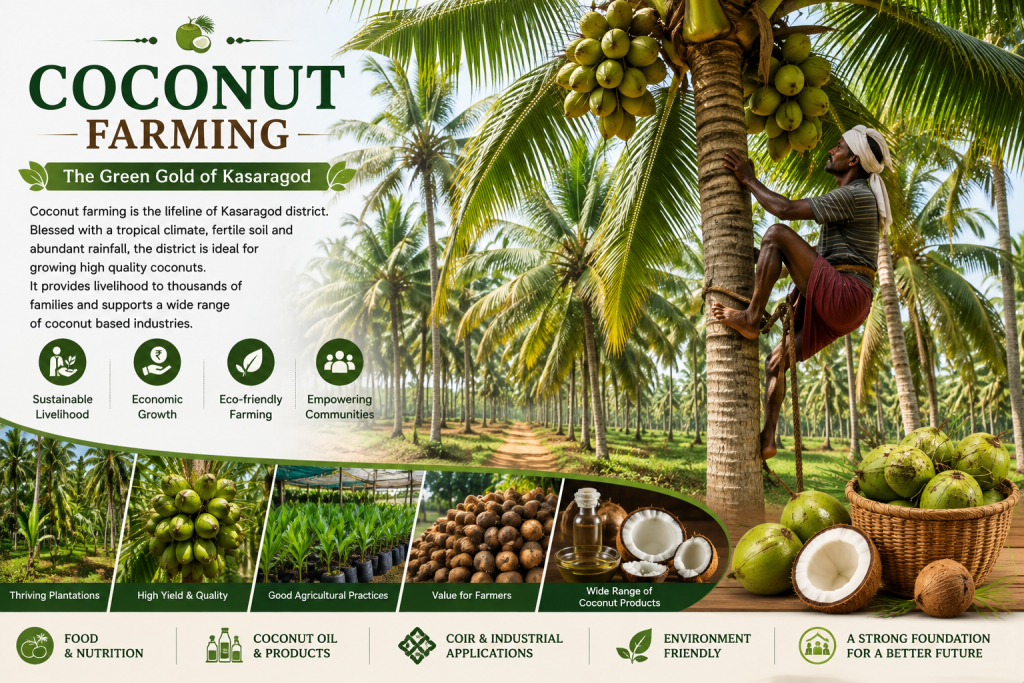
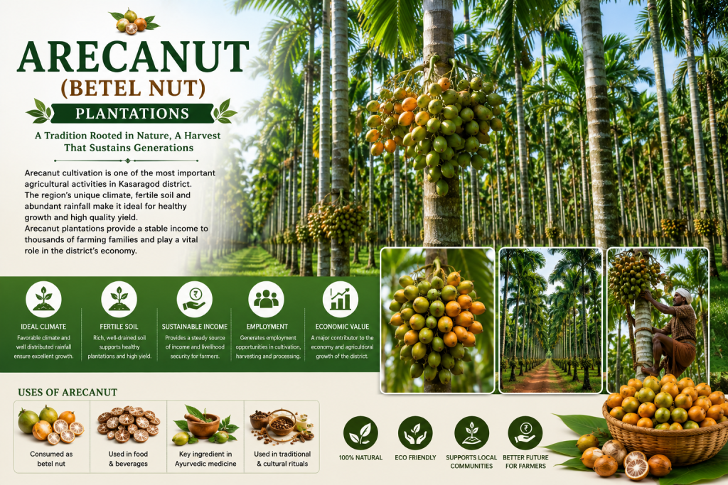
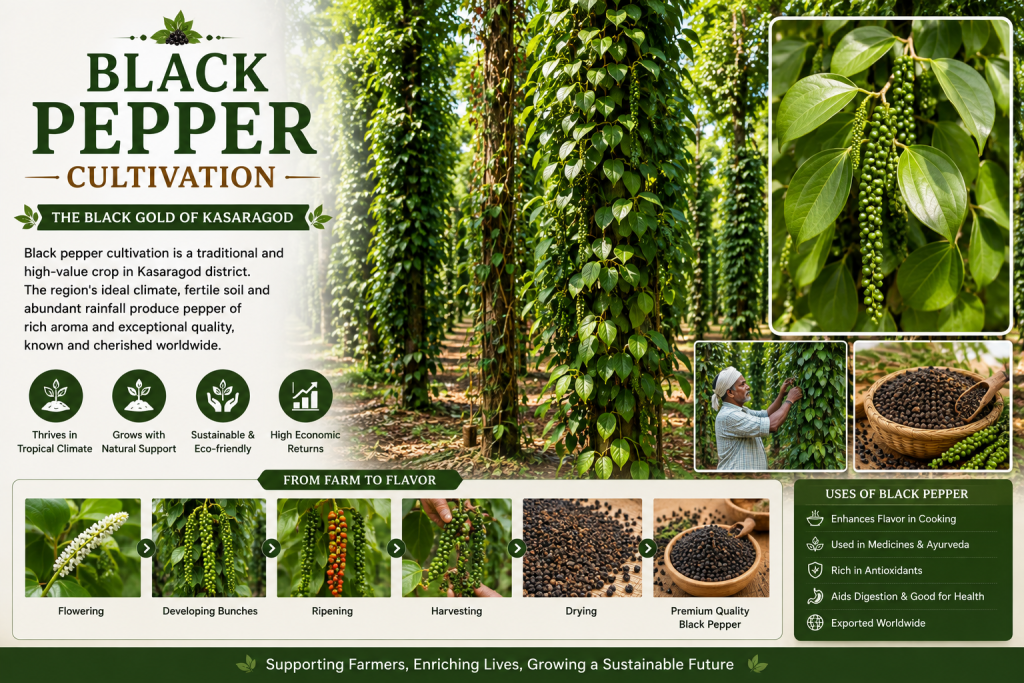
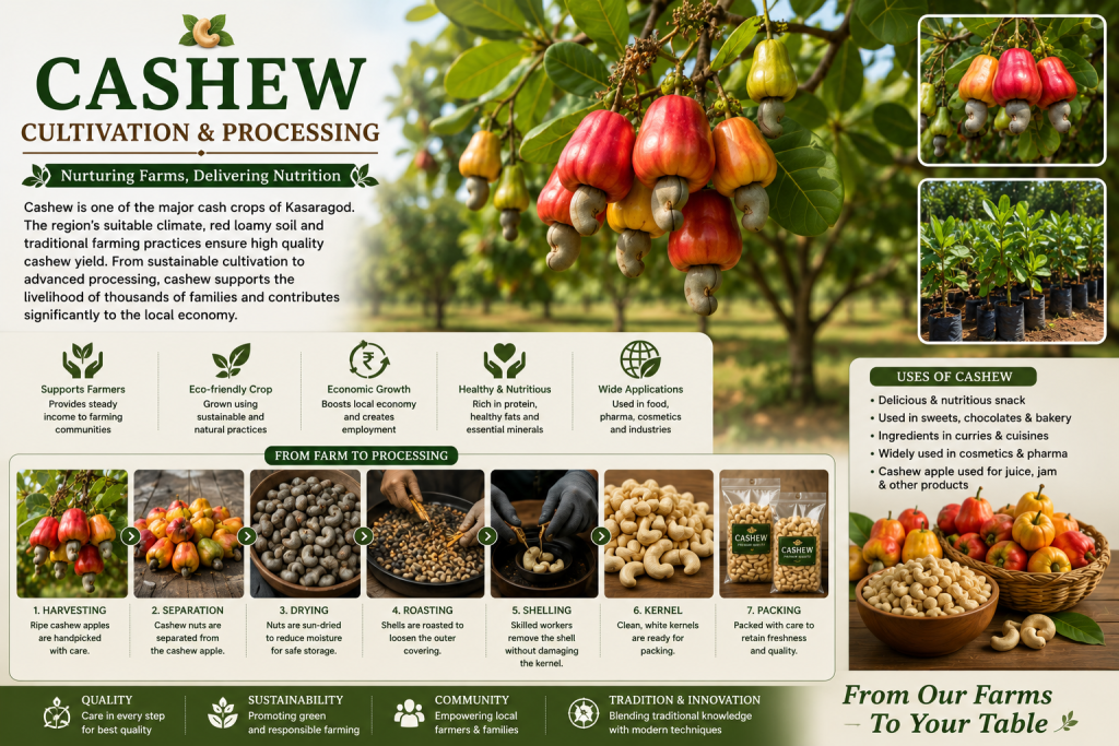

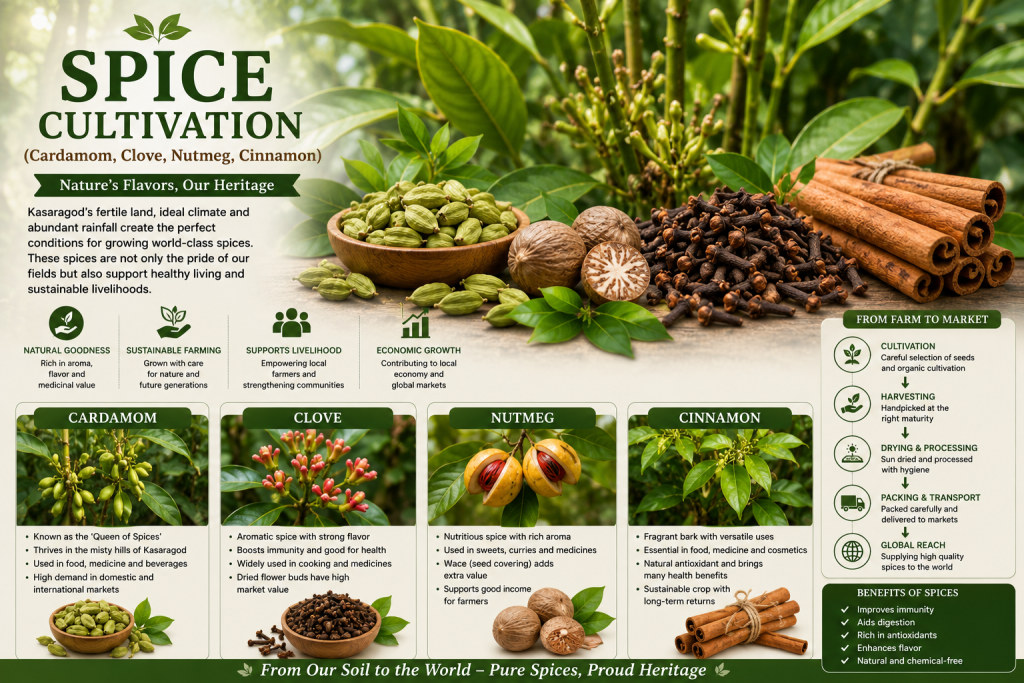
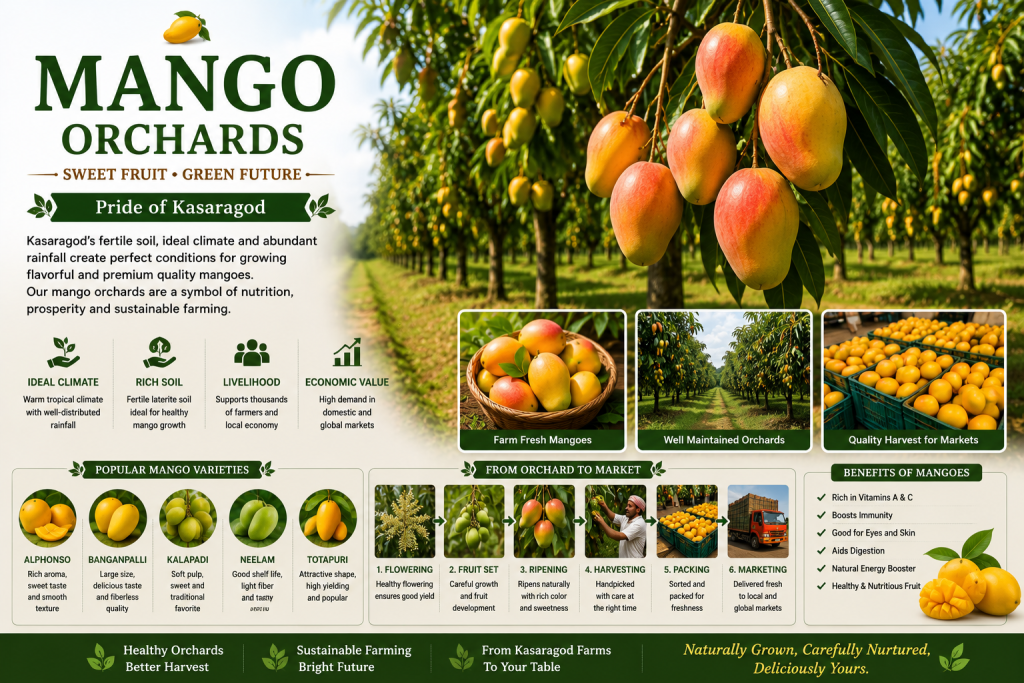
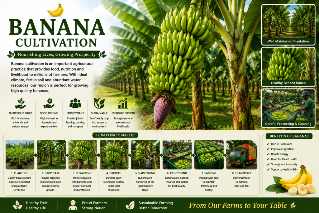
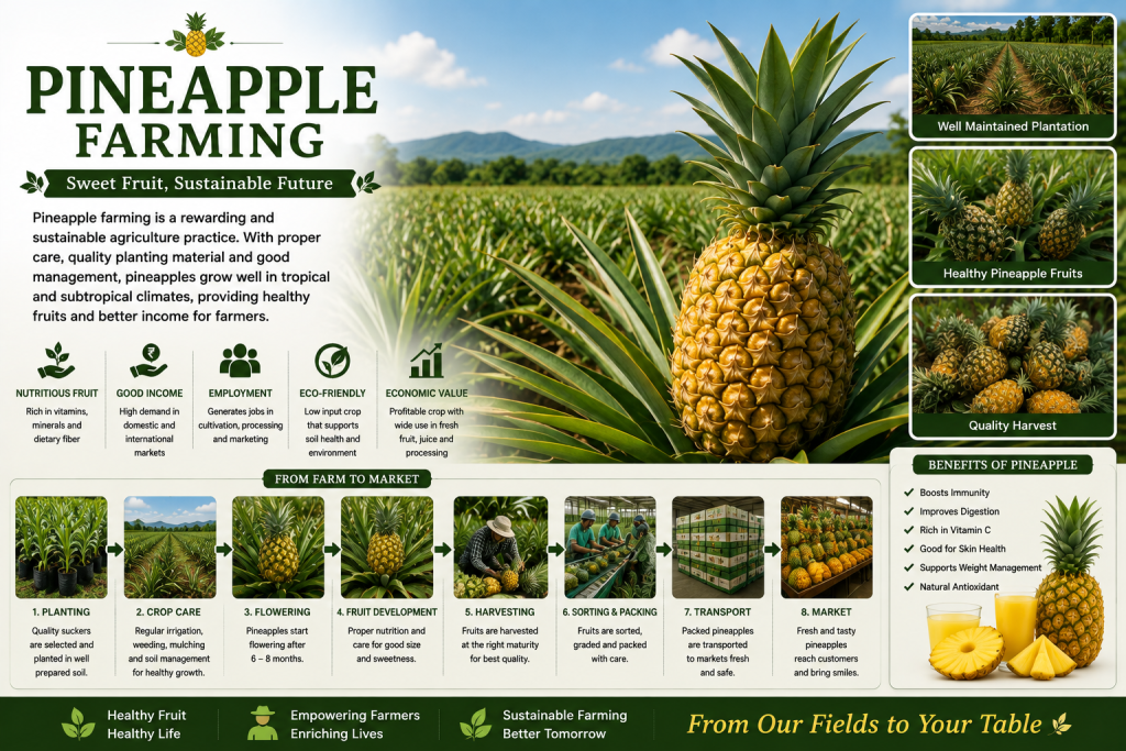
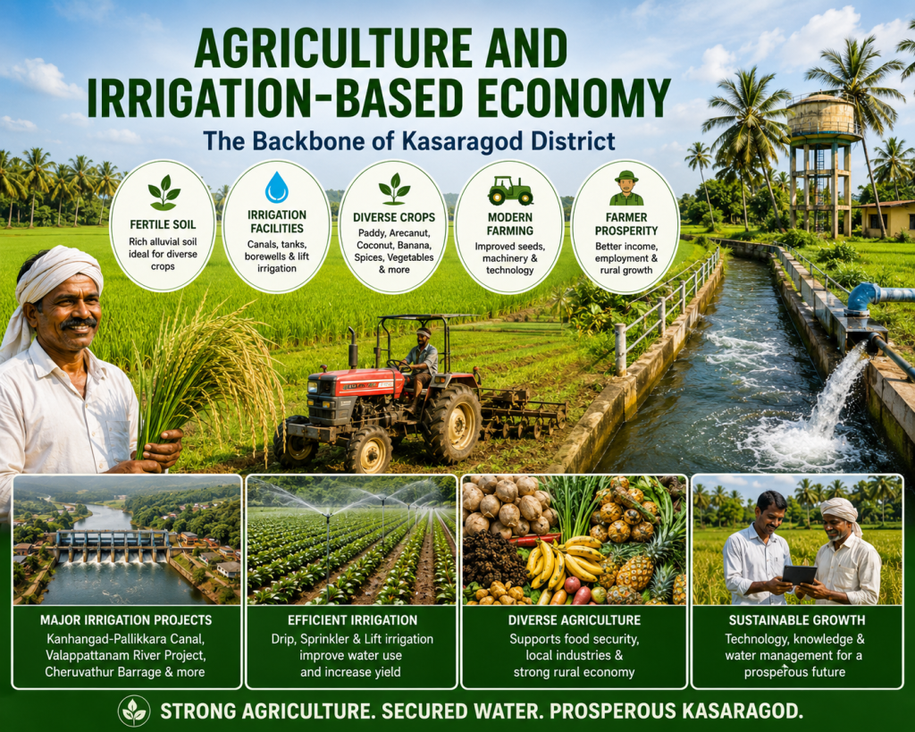
Agriculture is the backbone of Kasaragod District’s economy, supporting thousands of farming families and contributing significantly to rural livelihoods. Blessed with fertile soil, abundant rainfall, rivers, canals, and modern irrigation facilities, the district provides ideal conditions for cultivating a wide variety of crops. Major agricultural products include paddy, coconut, arecanut, banana, cashew, rubber, black pepper, spices, pineapple, vegetables, and fruits.
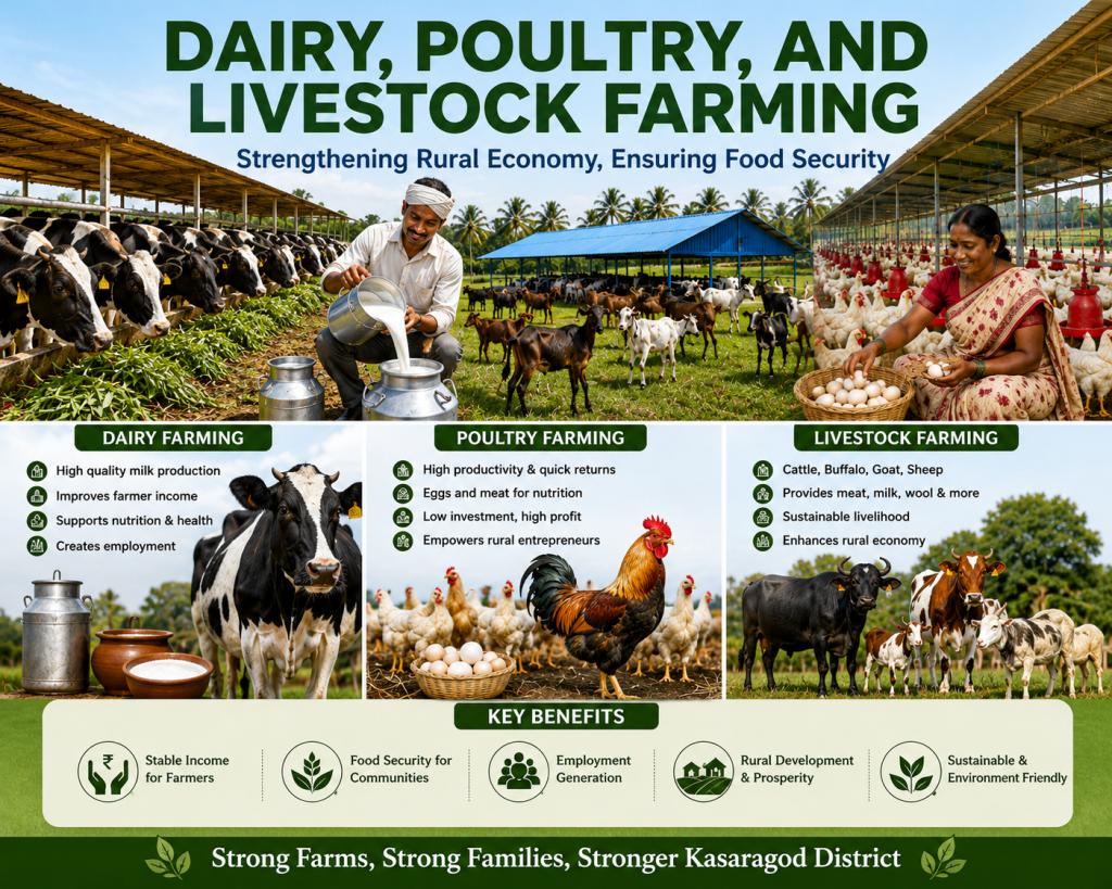
Dairy, poultry, and livestock farming are important pillars of Kasaragod District’s rural economy, providing sustainable livelihoods and strengthening food security. The district has a growing network of dairy farms, poultry units, and livestock enterprises that support thousands of farming families. Cattle, buffaloes, goats, sheep, and poultry contribute significantly to the production of milk, eggs, meat, and other essential products, creating employment and increasing rural incomes.
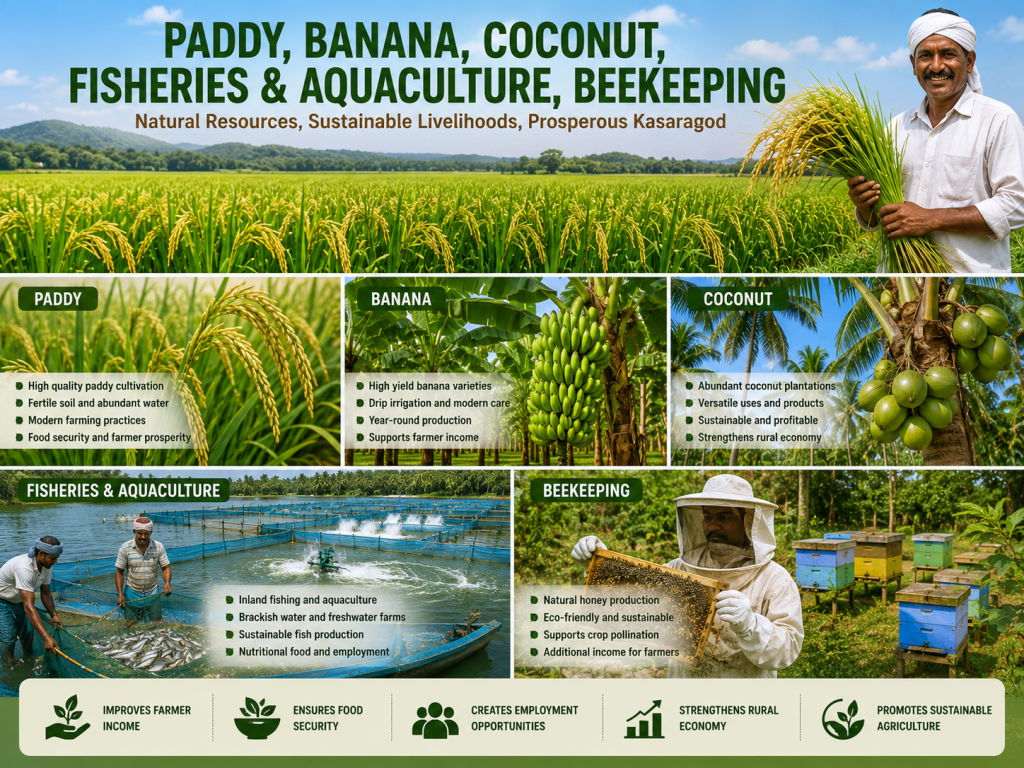
Kasaragod District is blessed with fertile land, a favorable tropical climate, abundant water resources, and a long coastline, making it an ideal region for diverse agricultural and allied activities. Paddy cultivation remains one of the district’s primary food crops, while banana and coconut plantations contribute significantly to farmers’ livelihoods and the local economy. Coconut farming supports a wide range of industries, including coconut oil, coir products, and other value-added products.

Education and healthcare are key pillars of Kasaragod District’s social and economic development. The district is home to a growing network of government and private schools, colleges, professional institutions, hospitals, community health centers, and primary healthcare facilities. These institutions provide quality education, skill development, modern medical services, and improved healthcare access, helping build a knowledgeable, healthy, and empowered society.
Culture and Festivals

Kasaragod District is renowned for its rich cultural heritage, vibrant traditions, and colorful festivals that reflect the harmony of its diverse communities. The district is famous for unique art forms such as Theyyam, Oppana, Yakshagana, Kalaripayattu, and traditional folk music, which have been preserved for generations. Grand temple festivals, mosque celebrations, church feasts, and cultural events bring people together, showcasing the district’s spirit of unity, devotion, and mutual respect.
Major festivals celebrated in Kasaragod include Vishu, Onam, Makaravilakku, Ramzan (Eid), Bakrid, Deepavali, and Christmas. Traditional rituals, vibrant processions, folk performances, music, dance, boat festivals, and local fairs attract visitors from across the region. These cultural celebrations preserve the district’s heritage, promote tourism, strengthen community bonds, and contribute to the cultural identity and pride of Kasaragod District.
Climate and Seasons
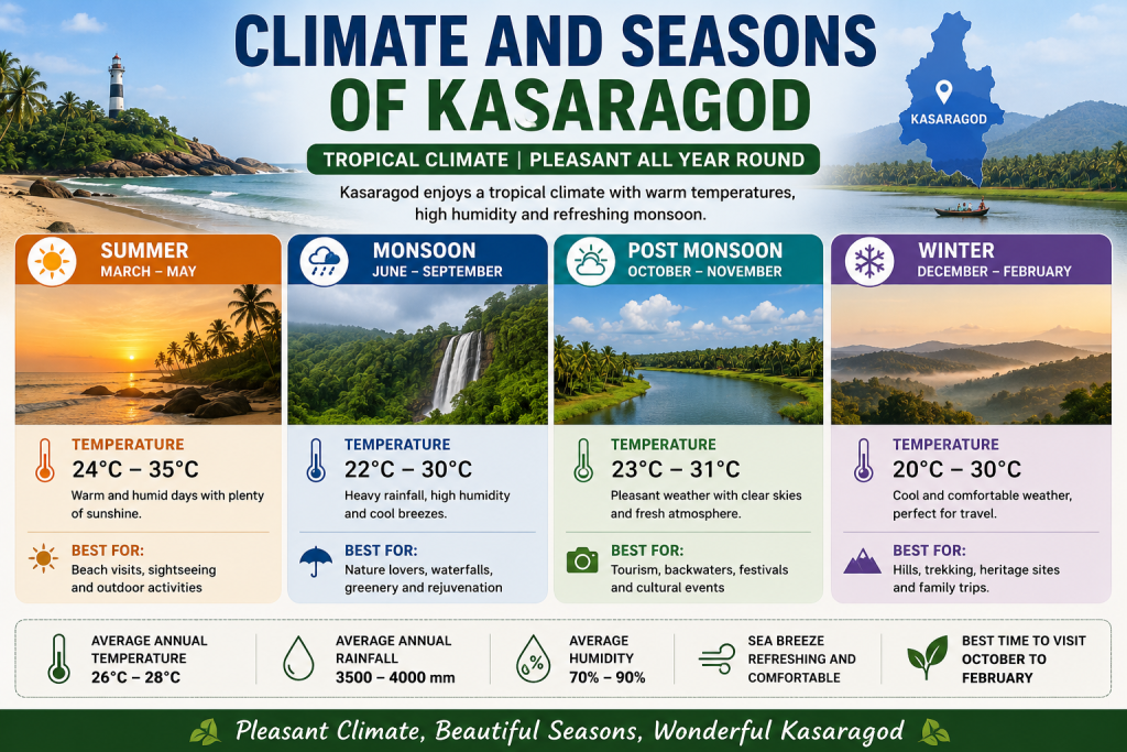
Kasaragod District enjoys a pleasant tropical climate throughout the year, influenced by the Arabian Sea and the Western Ghats. The district experiences warm summers, refreshing monsoon rains, comfortable post-monsoon weather, and mild winters, making it an attractive destination in every season. Temperatures generally range from 20°C to 35°C, while abundant rainfall keeps the region green and supports agriculture, forests, rivers, and biodiversity.
The summer season (March–May) is warm and sunny, ideal for beaches and sightseeing. The monsoon season (June–September) brings heavy rainfall, lush greenery, and spectacular waterfalls. The post-monsoon season (October–November) offers clear skies and pleasant weather, making it one of the best times for tourism and outdoor activities. During winter (December–February), the climate remains cool and comfortable, providing perfect conditions for visiting historical sites, temples, beaches, wildlife areas, and the scenic landscapes of Kasaragod District.
Road Connectivity
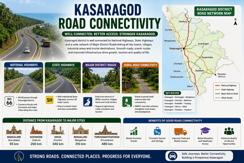
Kasaragod District has a well-developed road network that connects towns, villages, tourist destinations, industrial areas, and neighboring states. The district is served by National Highway 66 (NH-66), which runs along the western coast of India and provides seamless connectivity to major cities such as Mangaluru, Udupi, Kannur, Kozhikode, Kochi, and Thiruvananthapuram. State highways and major district roads further link the interior regions, ensuring smooth transportation for residents, businesses, and visitors.
A strong road infrastructure plays a vital role in supporting agriculture, trade, tourism, education, healthcare, and economic development. Well-maintained highways and rural roads improve access to markets, schools, hospitals, and government services while promoting regional growth and employment. With continuous infrastructure development, Kasaragod District offers safe, efficient, and reliable road connectivity, making travel convenient and strengthening its position as an important gateway between Kerala and Karnataka.
Railway Connectivity
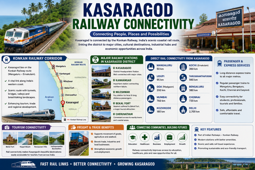
Kasaragod District enjoys excellent railway connectivity through the Konkan Railway, one of India’s most scenic and important railway corridors. The district is served by major railway stations including Kasaragod, Kanhangad, Nileshwar, Bekal Fort, and Cheruvathur, providing convenient access for passengers, tourists, students, and businesses. These stations connect the district to major cities such as Mangaluru, Udupi, Goa, Mumbai, Kozhikode, Kochi, Bengaluru, Chennai, Delhi, and Thiruvananthapuram, making long-distance travel comfortable and efficient.The railway network plays a vital role in supporting tourism, trade, agriculture, and industrial development by enabling the smooth movement of passengers and goods. It improves access to educational institutions, healthcare facilities, employment opportunities, and commercial markets while strengthening regional connectivity. With modern railway infrastructure and regular passenger and express train services, Kasaragod continues to enhance economic growth, promote sustainable transportation, and serve as an important gateway between Kerala and Karnataka.
Air Connectivity
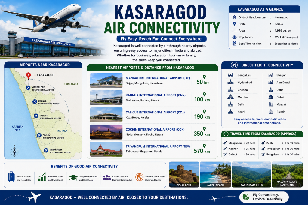
Kasaragod District enjoys excellent air connectivity through several nearby international airports, making travel convenient for residents, tourists, students, and business travelers. The nearest airport is Mangalore International Airport (50 km), offering regular domestic and international flights. Other nearby airports include Kannur International Airport (100 km), Calicut International Airport (190 km), Cochin International Airport (350 km), and Thiruvananthapuram International Airport (570 km), providing seamless access to destinations across India and abroad.Strong air connectivity supports tourism, trade, education, healthcare, and investment by enabling fast and efficient travel. Direct flight services to major cities such as Bengaluru, Chennai, Hyderabad, Mumbai, Kochi, Delhi, and international destinations in the Middle East make Kasaragod easily accessible. With its strategic location and proximity to multiple airports, the district continues to strengthen economic growth, promote tourism, and enhance connectivity with national and global destinations.
District Of Kasaragod
District Overview
Kasaragod is the northernmost district of Kerala, known for its rich cultural heritage, scenic landscapes, and diverse traditions. Bordered by Karnataka to the north, the Arabian Sea to the west, and the Western Ghats to the east, the district offers a unique blend of beaches, hills, forests, rivers, and historical monuments. Kasaragod is famous for iconic attractions such as Bekal Fort, Ranipuram Hills, Ananthapura Lake Temple, and its vibrant Theyyam performances, making it a popular destination for tourists and nature lovers.
The district has a strong economy driven by agriculture, fisheries, tourism, education, healthcare, and small-scale industries. Major crops include paddy, coconut, arecanut, cashew, banana, black pepper, rubber, and spices. Well-connected by road, rail, and nearby international airports, Kasaragod continues to grow as an important center for trade, culture, and sustainable development while preserving its natural beauty and multicultural heritage.
History of Kasaragod
Kasaragod has a rich and fascinating history that dates back to ancient times. Due to its strategic location along the Arabian Sea, the region became an important center for trade and cultural exchange. Arab, Portuguese, and European traders visited Kasaragod to trade spices, coconut products, and other valuable goods. Over the centuries, the district came under the rule of several dynasties, including the Kolathiri Kingdom, Ikkeri Nayakas, Keladi rulers, and later Tipu Sultan of Mysore.
During the British period, Kasaragod was part of the South Canara district under the Madras Presidency. After India’s independence in 1947, the region became part of Kerala following the States Reorganisation Act of 1956, based on language. Recognizing its unique identity and growing importance, Kasaragod was officially declared the 14th district of Kerala on 24 May 1984. Today, Kasaragod is known for its multicultural heritage, historic forts, ancient temples, beautiful beaches, and vibrant traditions, making it one of Kerala’s most distinctive and culturally rich districts.
Kasaragod District Statistics
| Category | Details |
|---|---|
| State | Kerala |
| District Headquarters | Kasaragod |
| Established | 24 May 1984 |
| Total Area | 1,989 sq. km |
| Population | Approximately 13.1 Lakhs |
| Population Density | Around 654 persons per sq. km |
| Literacy Rate | About 90.09% |
| Official Language | Malayalam |
| Other Languages | Tulu, Kannada, Konkani, Beary, Marathi, Tamil, Hindi, English |
| Taluks | Kasaragod, Hosdurg, Manjeshwar, Vellarikundu |
| Block Panchayats | 6 |
| Grama Panchayats | 38 |
| Municipalities | Kasaragod, Kanhangad, Nileshwar |
| Major Rivers | Chandragiri, Tejaswini (Payaswini), Uppala, Shiriya |
| Highest Peak | Ranipuram Hills |
| Climate | Tropical Monsoon |
| Average Temperature | 20°C – 35°C |
| Annual Rainfall | Approximately 3,000–3,800 mm |
| Major Crops | Paddy, Coconut, Arecanut, Cashew, Banana, Rubber, Black Pepper, Spices |
| Main Occupations | Agriculture, Fisheries, Tourism, Trade, Education, Healthcare |
| Famous Tourist Attractions | Bekal Fort, Ranipuram, Ananthapura Lake Temple, Madhur Temple, Chandragiri Fort, Kappil Beach |
| Nearest International Airport | Mangalore International Airport (≈50 km) |
| Major Railway Stations | Kasaragod, Kanhangad, Nileshwar, Bekal Fort, Cheruvathur |
| National Highway | NH-66 |
| Coastline | Arabian Sea |
Administrative Divisions
Administrative Divisions of Kasaragod District
Kasaragod District is divided into 4 Taluks, 6 Block Panchayats, 38 Grama Panchayats, and 3 Municipalities, ensuring efficient local governance and public service delivery.
Taluks
- Kasaragod
- Manjeshwar
- Hosdurg
- Vellarikundu
Municipalities
- Kasaragod Municipality
- Kanhangad Municipality
- Nileshwar Municipality
Block Panchayats
- Kasaragod
- Manjeshwar
- Kanhangad
- Neeleshwar
- Parappa
- Karadka
Local Self-Government Institutions
- Grama Panchayats: 38
- Municipalities: 3
- Corporations: None
Revenue Administration
- District Headquarters: Kasaragod
- Revenue Divisions: 2
- Villages: 75
District Measurements
| Measurement | Details |
|---|---|
| District Name | Kasaragod |
| State | Kerala |
| Established | 24 May 1984 |
| Geographical Area | 1,989 sq. km |
| Elevation | Approximately 19 metres (62 ft) above sea level |
| Latitude | 12.50° N |
| Longitude | 75.00° E |
| Population | Approximately 13.1 Lakhs |
| Population Density | 654 persons per sq. km |
| Literacy Rate | 90.09% |
| Taluks | 4 |
| Revenue Divisions | 2 |
| Villages | 75 |
| Grama Panchayats | 38 |
| Municipalities | 3 |
| Coastline | Approximately 27 km along the Arabian Sea |
| Major Rivers | Chandragiri, Tejaswini (Payaswini), Uppala, Shiriya |
| Highest Point | Ranipuram Hills (Approx. 1,048 m) |
| Climate | Tropical Monsoon |
| Average Temperature | 20°C – 35°C |
| Annual Rainfall | 3,000–3,800 mm |
| Time Zone | IST (UTC +5:30) |
Revenue Administration Statistics
| Category | Statistics |
|---|---|
| District Headquarters | Kasaragod |
| Revenue Divisions | 2 |
| Revenue Division Offices (RDOs) | Kasaragod, Kanhangad |
| Taluks | 4 |
| Villages | 75 |
| Block Panchayats | 6 |
| Grama Panchayats | 38 |
| Municipalities | 3 |
| District Panchayat | 1 |
| National Highway | NH-66 |
| Major Railway Stations | Kasaragod, Kanhangad, Nileshwar, Bekal Fort, Cheruvathur |
| Nearest International Airport | Mangalore International Airport (Approx. 50 km) |
Education and healthcare
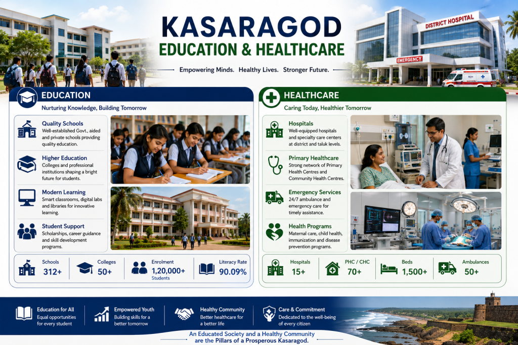
Education and healthcare are the foundation of Kasaragod District’s sustainable development and social well-being. The district has a strong network of government and private schools, colleges, technical institutions, hospitals, community health centers, and primary healthcare facilities that provide quality education and accessible medical services. Continuous investments in modern infrastructure, digital learning, skilled professionals, and advanced healthcare facilities are helping build a healthier, better-educated, and more prosperous society. Kasaragod is committed to improving educational opportunities, enhancing healthcare services, and promoting community welfare through various government initiatives and public institutions. Modern classrooms, libraries, laboratories, hospitals, emergency care centers, and specialized medical services ensure better learning outcomes and improved public health. Together, the education and healthcare sectors create employment opportunities, strengthen human development, improve quality of life, and contribute significantly to the overall growth and prosperity of Kasaragod District.
kasaragod district
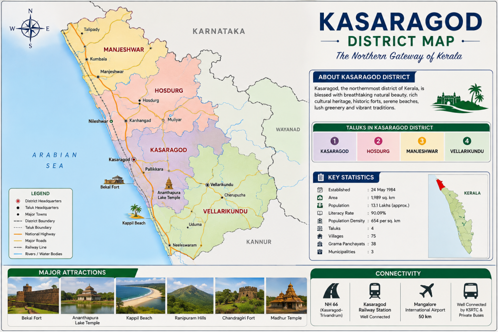
- Population: Approximately 13.1 Lakhs
- Area: Approximately 1,989 sq. km
- Literacy Rate: Approximately 90.09%
- Altitude: Approximately 19 meters above sea level
- Population Density: Approximately 654 persons per sq. km
- Major Rivers: Chandragiri River, Tejaswini (Payaswini) River, Uppala River, Shiriya River
- Main Occupation: Agriculture, Fisheries, Tourism, Trade, and Small-Scale Industries
- Major Crops: Paddy, Coconut, Arecanut, Cashew, Banana, Black Pepper, Rubber, Mango, Pineapple, and Spices
- Famous Tourist Places: Bekal Fort, Ranipuram Hills, Ananthapura Lake Temple, Madhur Temple, Chandragiri Fort, Bekal Beach, Valiyaparamba Backwaters, Kottancheri Hills
- Famous Festivals: Onam, Vishu, Theyyam Festival, Ramzan (Eid-ul-Fitr), Bakrid (Eid-ul-Adha), Christmas, Deepavali, Navaratri, Temple Festivals, and Local Cultural Festivals